
ACTINOMETRIC OBSERVATIONS
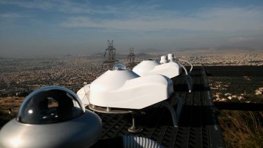
The expanding network of radiometric stations includes two stations within Attica region, the historic radiometric station in Thissio and the newest in Penteli, but also six more stations scattered throughout Greece: in Klokotos (Trikala), in Larissa (Thessaly), in Methoni (Messinia, South Peloponnese), in Filotas (Florina), in Andros island (Cyclades) and in Antikythira island. Also included is another high altitude station (at 2340 m) in Neraidorahi site of Helmos mountain in Kalavryta (Achaia).
At all of the above stations, the intensity of the total incoming solar radiation (in W/m2) incident at a horizontal plane is recorded, in five of them the diffuse solar component (in W/m2) is recorded in parallel, while in four of them the duration of sunshine duration (in minutes) is also measured.
Both radiometric stations at Thissio and Penteli sites also record the intensity of the incoming Ultra-Violet solar radiation (Total UV, UV-A, UV-B, in W/m2) as well as the intensity of the natural daylight (in Lux) (Total and Diffuse components).
Furthermore, all basic meteorological parameters such as air temperature (oC) and relative humidity (%), atmospheric pressure (hPa), wind speed (m/sec) and direction (degrees) and total precipitation (mm) (rainfall, snow, hail) are recorded in parallel.
Real-time measurements of the above actinometric and meteorological parameters are widely available to the public through the following WEB link: www.iersd.noa.gr/WeatherOnLine.
For each parameter presented, the historic daily fluctuation is also available throughout the WEB-page for a period of 10 days.
All actinometric and meteorological observations and measurements are automatically saved in the database for further statistical analysis.
In order to apply for actinometric and/or meteorological data from stations of this network, please contact Dr. Psiloglou Vassilios (bill@noa.gr)
Solar Energy Applications Consultancy
Solar energy, calculation and forecast for any orientation and area.
Calculation of solar radiation in a horizontal plane and sloping surfaces for each region of the country. Provision of solar maps for solar energy applications for each region of the country.
Provision of solar energy forecasting tools for large solar installations (PV and CSP), for electricity network operators and companies or individuals active in the production and marketing of electricity, for each desired geographical area.
Calculation of solar energy in any orientation / surface in real conditions and cloudless sky, to calculate the efficiency of solar photovoltaic parks with different efficiencies.
Carrying out measurements of solar radiation on horizontal and inclined surfaces.
