


Meteorological Radar
The meteorological radar of IERSD focuses on research, as well as the recording and forecasting of severe weather phenomena, using modern meteorological equipment for in-situ and remote measurements of hydrometeors and other atmospheric targets.
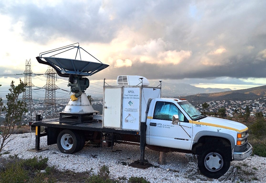
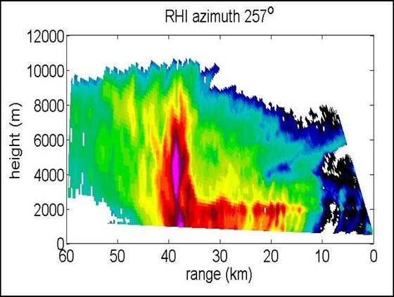
The meteorological radar (XPOL) of IERSD is a microwave Doppler radar (3.2 cm emission wavelength) that simultaneously emits electromagnetic signal pulses with vertical and horizontal polarization. The radar was built in collaboration with the National Center for Atmospheric Research of the USA and has been mounted on a small truck. The system’s range reaches 120 kilometers with a high resolution of 60 meters. It performs horizontal and vertical atmospheric cross-sections with a maximum antenna rotation speed of 25 degrees/second.
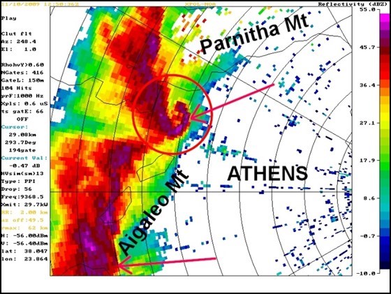
The primary measurements of the system include reflectivity (scattering from hydrometeors or other atmospheric targets, such as small particles, insects, or even birds) of horizontal and vertical polarization, wind speed (Doppler), spectrum width, and the phase difference between the two polarizations. From these measurements, the spatial distribution of atmospheric precipitation is calculated every few minutes, distinguishing between liquid and solid phases of water, as well as the wind field. The characteristics and sensitivity of the system make it particularly useful in hydrometeorological, pyrometeorological (pyrocumulonimbus), and biological (bird migrations) studies, as well as in agricultural applications (rainfall, hail), aviation safety (downbursts), and Civil Protection early warning systems (early flood warning).
Data from the meteorological radar and a nationwide lightning sensor network are assimilated in real-time into the WRF (Weather Research and Forecasting) meteorological prediction model. System measurements and short-term (up to 3 hours) forecasts of precipitation and near-surface wind are available in real-time on the website https://nowcast.meteo.noa.gr. The characteristics and sensitivity of the system make it particularly useful in hydrometeorological, pyrometeorological (pyrocumulonimbus), and biological (bird migrations) studies, as well as in agricultural applications (rainfall, hail), aviation safety (downbursts), and Civil Protection early warning systems (early flood warning). Data from the meteorological radar and a nationwide lightning sensor network are assimilated in real-time into the WRF (Weather Research and Forecasting) meteorological prediction model.
System measurements and short-term (up to 3 hours) forecasts of precipitation and near-surface wind are available in real-time on the website https://nowcast.meteo.noa.gr. The characteristics and sensitivity of the system make it particularly useful in hydrometeorological, pyrometeorological (pyrocumulonimbus), and biological (bird migrations) studies, as well as in agricultural applications (rainfall, hail), aviation safety (downbursts), and Civil Protection early warning systems (early flood warning). Data from the meteorological radar and a nationwide lightning sensor network are assimilated in real-time into the WRF (Weather Research and Forecasting) meteorological prediction model. System measurements and short-term (up to 3 hours) forecasts of precipitation and near-surface wind are available in real-time on the website https://nowcast.meteo.noa.gr.
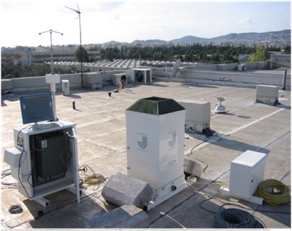
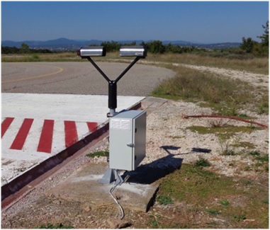
Disdrometers and rain gauges: In parallel with the meteorological radar, IERSD has optical and laser disdrometers for in-situ measurement of rain characteristics, and precision rain gauges installed near the meteorological radar and used to check its calibration and measurement accuracy. Disdrometers use optical or laser light beams to record the fall speed, diameter, shape, and orientation angle of each hydrometeor passing through the beams. Subsequently, the size distribution of hydrometeors and the intensity of precipitation (rain, hail, snow) are calculated.