|
||||||||||||||||||||||||||||||||||||||||||||||||||||||||||||||||||||||||||||||||
| Click on the plots below or select the right arrow for the last 10-days |
| |
|
| |
|
| |
|
| |
|
| |
|
| |
|
| |
|
| |
|
| |
|
| |
|
| |
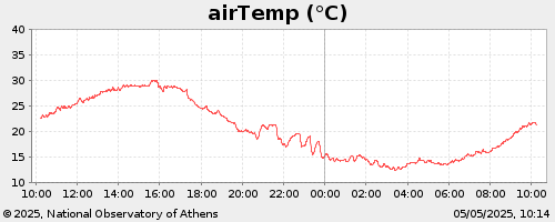
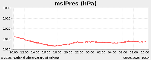
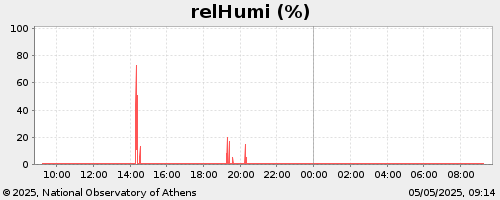
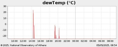
The data presented are collected on-line from the Meteorological & Actinometric Station of the IERSD-NOA, located at Larisa area.
These data are updated every 10 minutes.
The automatic meteorological station at Larisa is deployed by IERSD/NOA under collaboration with the Institute of Industrial & Forage Crops (IIFC). Thanks to Dr. L. Toulios General Director of IIFC, A. Tsitouras from IIFC and N. Kappos from NOA for their valuable help during the station deployment.
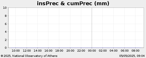
(1) The value of the cumulative precipitation is reset to zero at 08:00 and at 20:00 every day.
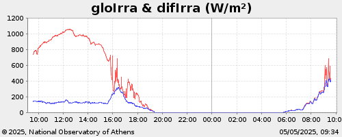
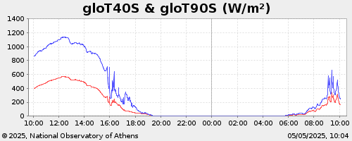
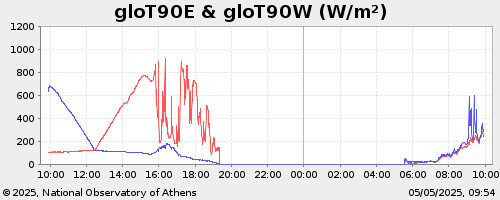
(2) The values of irradiance are referred to horizontal plane.
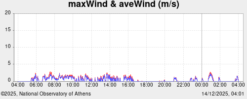
(3) The wind measurments are at 10m above the ground.
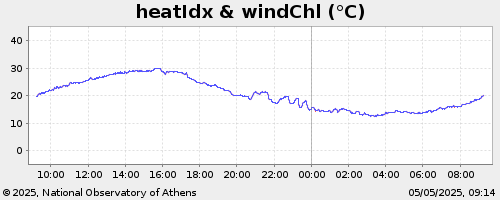
(4) The values of Heat or Discomfort Index are estimated using Air Temperature and Relative Humidity measurements.
(5) The values of Wind Chill are estimated using Air Temperature and Wind Speed measurements.
(6) The values of irradiance on tilted surfaces with different orientations are estimated incorporating HAY's model.
For PV applications, estimation of irradiance received on different tilted surfaces and using different models can be available after communication with the Reseacher involved.
Position of Larisa Station
Latitude:
39° 36.59' N.
Longitude: 22° 25.33' E.
Height above sea level: 110 m
Starting Day: January 2019
 Senior Researcher
bill@noa.gr
+30 210 8109133
CV
Keep up-to-date with the latest news and updates by subscribing to NOA newsletter!